Glacier Bay National Park
3.3 Million Acres of Mountains, Glaciers, Fjords and More!
Glacier Bay National Park and Preserve in Alaska is home to snow covered mountain peaks, huge glaciers and humpback whales. Located in Alaska’s panhandle west of Juneau, it was declared a national monument by President Calvin Coolidge in 1925 and designated a national park in 1980.
Open / Close / Reopening Status of Glacier Bay National Park due to Coronavirus (COVID-19)
More information about Glacier Bay
Last Updated: May 2, 2020
History
The Tlingit people have occupied the area of Glacier Bay for countless centuries, living among the glaciers, and using all they could pull from the land and sea to survive. In 1794, Captain George Vancouver sailed the aera, sketching a map that showed a single giant glacier in the bay. In 1879, John Muir, with the help of Tlingit guides, explored the area by canoe, and his melodic writings on the bay changed the view of Alaska from cold starkness to mystical beauty. Muir came intrigued by glaciology, convinced a glacier had carved his beloved Yosemite, and determined that the glacier had significantly retreated from the size observed by Vancouver, some eighty years before. In 1916, a plant ecologist from Minnesota, William S Cooper, visited for the first of many times, to observe and learn about the plants in the area. He advocated for the preservation of the area, and in 1925, Glacier Bay was declared a national monument. It was redesignated as a national park in 1980.
Entrance fee
There is no fee to enter, although getting there (aircraft etc) may require fees. This is unlike most national parks which have a fee. The park receives the majority of its annual budget from cruise ship fees instead of the entrance fees. The charging of cruise ships based on the number of passengers as well as the allocation of the majority of the fees to the park was established in the 1990s by former U.S. Senator Frank Murkowski (R-AK). Sixty percent of the cruise ship passenger fees goes straight to the park and the other 40% is treated like traditional fees with 20% going to Washington, DC for reallocation among the parks.
Glacier Bay National Park was converted from a national monument by Alaska National Interest Lands Conservation Act of 1980. It also extended the boundary northwest to the Alsek River and Dry Bay. The ANILCA also created Kobuk Valley National Park, Lake Clark National Park, Wrangell-Saint Elias National Park, and Katmai National Park. The legislation also redesignated Mount McKinley National Park as Denali National Park.
In 1986, the Glacier Bay-Admiralty Island Biosphere Reserve was established under the United Nations Man and the Biosphere Program. It also became part of an international World Heritage Site in 1992.
Visiting the Park
The majority of people spend either less than one day (Alaska cruises) or between 1 and 2 days in Glacier Bay National Park. The national park has been considering options to expand the frontcountry amenities in the park to make longer stays more desirable. The developed area around Bartlett Cove is small compared to the size of the three million acre park and other national park destinations. There are a few trails, the visitor center, lodge, boat dock and a few short hiking trails. Longer trips typically involve multi-day kayaking, fishing, whale watching or birding trips.
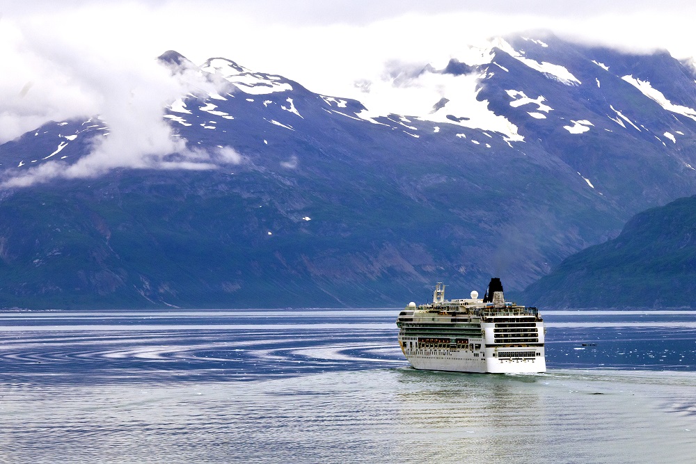
Alaska cruise ships are a popular way to see Glacier Bay National Park, as most spend a full day in the waters of the park, allowing rangers to board near the Visitor Center and travelling more than 120 miles while in Glacier Bay. Cruise passengers get nine to ten hours to search the sea and shoreline for glaciers, wildlife and marine mammals like whales. There is a limit on the daily number of Alaska cruises which can enter the national park, so be sure to check your itinerary before booking.
Mount Fairweather
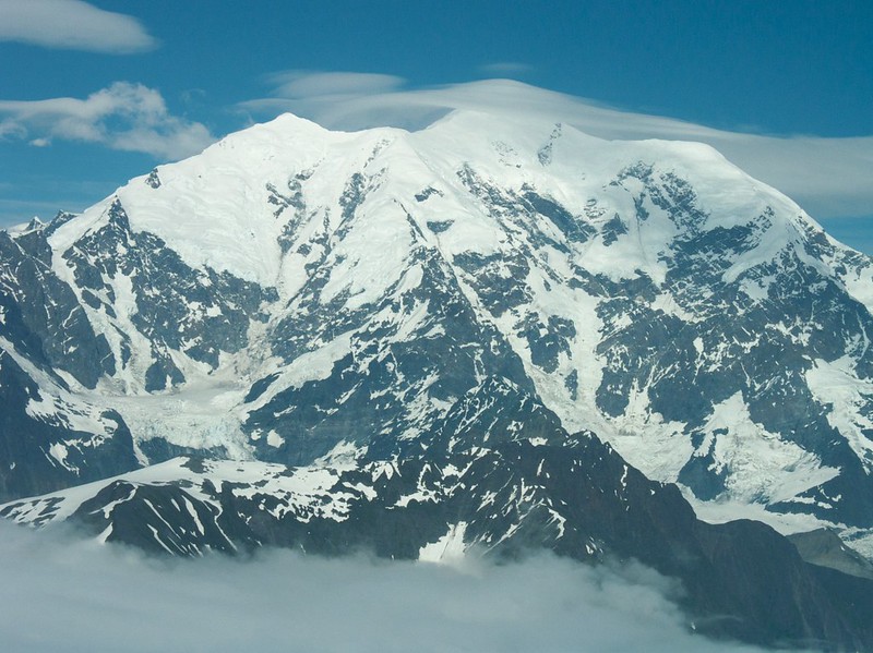
Mt. Fairweather sits on the border of British Columbia and Alaska. It is the highest peak in British Columbia at 15,300 feet, even though most of the mountain is located in Alaska and Glacier Bay National Park. It is the highest and northernmost summit in Glacier Bay National Park, dominating the skyline for miles. Only 12 miles from the Gulf of Alaska, it is one of the highest coastal peaks in the world. It was named by Captain James Cook in 1778, while he was navigating Glacier Bay.
Glacier Bay Glaciers
There are over 1,000 glaciers in Glacier Bay National Park. There are a few well-known tidewater glaciers that extend to the sea, but most are located high in the mountains. At one time during the Little Ice Age in the 18th Century, the entire bay was covered by the Grand Pacific Glacier from approximately 1750 to 1780. 27 percent of the park is currently covered by ice.
Grand Pacific Glacier
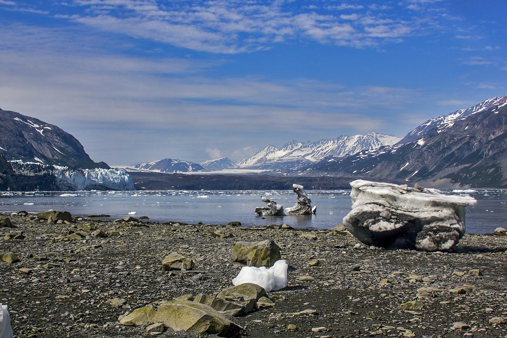
Grand Pacific Glacier spans two countries and is over 35 miles in length. It is the longest glacier that is found within the park. The recession of Grand Pacific has in the past few years separated it from Margerie Glacier. It is two miles wide at its terminus, and averages about 150 feet high at the ice face.
Margerie Glacier
Margerie Glacier is about one mile mile wide, with an ice face at the sea of about 250 feet high above the waterline. It is approximately 21 miles long and begins in the Fairweather Range. Margerie Glacier is approximately 55 nautical miles from Bartlett Cove.

Lamplugh Glacier
This glacier is often a stop on Alaska cruises through the park and is noted for the intense blue color of ice. It is fed by the Brady Icefield east of the Fairweather Range.
Johns Hopkins Glacier and Inlet
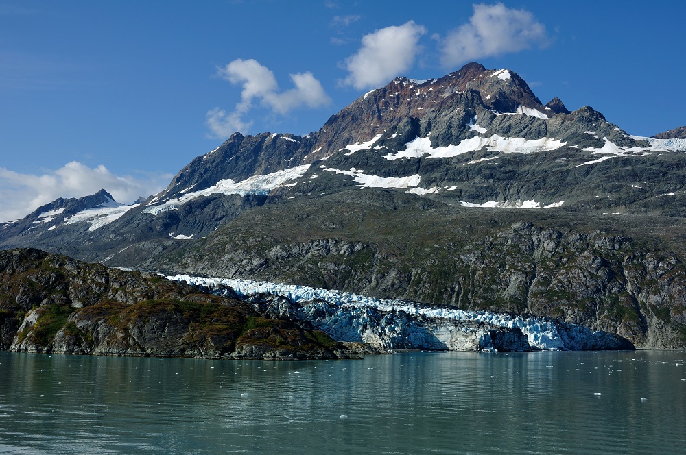
The National Park Service indicates that this is one of the most scenic glaciers in the park. It is the fastest glacier in the park. The Johns Hopkins Glacier is about 63 nautical miles away from Bartlett Cove. It is located in the John Hopkins Inlet.
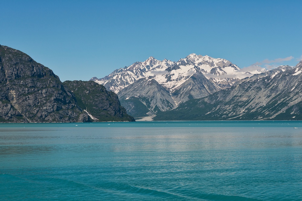
Glacier Bay Cruises
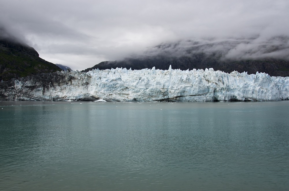
More than half of the park’s visitors see it on a cruise ship every year. Many people choose glaciers outside of the park as their favorite, such as Hubbard Glacier or Dawes Glacier. But Glacier Bay cruise passengers consistently pay more for Alaska cruises that include Glacier Bay on the itinerary.
The National Park Service awarded contracts to seven cruise ships for a ten year period beginning at the end of 2019. Royal Caribbean later announced that it had decided to not visit Glacier Bay National Park between 2020 and 2029. It did not finalize the contract with the National Park Service and the park confirmed it.Royal Caribbean has replaced Glacier Bay with Endicott Arm and Dawes Glacier, or Skagway.
The cruise lines allowed in Glacier Bay are Princess, Holland America, Norwegian, Carnival (Cunard), Seabourn, and Viking. Glacier Bay National Park allows two Glacier Bay cruises per day with a maximum of 153 each summer. 71 use days are allocated to Holland America Line and Princess Cruises. They have the right to continue the same level of service that they conducted prior to 1979 as historical operators.
The Alaska cruises pays a fee of $8.28 per person and are required to pick up a Park Ranger at the entrance of Glacier Bay to direct the vessel down the bay and interpret the attractions for visitors.
Glacier Bay 2020 and 2021 Cruise Options
Carnival, Princess, and Holland America have cancelled all 2020 Alaska cruises as of its announcement in the beginning of May due to coronavirus and social distancing.
Norwegian Bliss 7 Day Alaska: Glacier Bay, Skagway & Juneau – This is a week long round trip departing and returnig to Seattle with Glacier Bay on the itinerary.
Norwegian Sun 9 Day Alaska Round-trip Seattle: Glacier Bay, Skagway & Juneau
Seabourn Odyssey 7 Day Alaska Fjords Canadian Inside Passage – This one way Seabourn Alaska cruise departs from Juneau, sails through Glacier Bay and then goes south to disembark at Vancouver
Seabourn Odyssey 21-Day Grand Alaska & Gold Coast – This three week Alaska cruise departs from Vancouver and heads north to Glacier Bay and Hubbard Glacier before returning south to allow passengers to disembark at Los Angeles.
Seabourn Odyssey 14-Day Alaska Glaciers, Fjords & Inside Passage – This two week trip starting and ending in Vancouver travels north and includes both Glacier Bay and Hubbard Glacier.
Seabourn Odyssey 11-Day Inside Passage & Alaska Fjords – This Alaska cruise starts at Whittier and heads south while viewing both Hubbard Glacier and Glacier Bay.
Seabourn Odyssey 7-Day Glaciers & Alaska Inside Passage – This Seabourn cruise starts at Vancouver and ends at Juneau, with a trip up through the West Arm of Glacier Bay.
Disney Cruise Lines does not sail through Glacier Bay National Park.
Alternatives to Glacier Bay on an Alaska Cruise
Dawes Glacier is a shore excursion in the Endicott Arm Fjord that provides close views of Dawes Glacier. Royal Caribbean calls Endicott Arm “[o]ne of Alaska’s lesser-known gems”. It is one of the largest breeding grounds for harbor seals. Endicott Arm concludes at Dawes Glacier which is a tidewater glacier a half mile wide that stands over 200 feet tall with another 250 feet below the water.
Tracy Arm is a fjord located about 45 miles south of Juneau with glacier-carved cliffs, waterfalls, tidewater glaciers and more. Carnival calls it “one of the most spectacular cruise destinations”. It is named for Secretary of the Navy Benjamin Franklin Tracy.
Icy Strait Point is a cruise ship port on Chichagof Island north of Hoonah across Icy Strait from Glacier Bay and Gustavus. There are 20+ shore excursions including whale watching and bear viewing.
Hubbard Glacier is a tidewater glacier in Wrangell – St. Elias National Park near Yakutat. It is the longest tidewater glacier in North America and is located in Disenchantment Bay. Unlike most glaciers, it advances (grows larger) in warm weather due to the weather patterns that lead to more moisture falling in the higher elevations of the mountains at the start of the glacier. It has been said that it is more impressive than the glaciers in Glacier Bay, but it is harder to say whether the boat will be able to get close enough to truly enjoy it due to ice in the water. It is also shorter than Glacier Bay, which lasts about eight hours as the ship moves up the bay and then back down.
Skagway – If your ship has a port of call at Skagway, you can book a shore excursion for a Glacier Bay flightseeing trip in order to add the national park to your trip.
Dry Bay and Glacier Bay National Preserve
The national preserve extends the park boundary northwest to Dry Bay and the Alsek River. Dry Bay is the name for the 80 square mile delta of the Alsek River which forms multiple channels and is known for its low water levels.
Dry Bay is the usual take-out for rafting and boating for around 150 miles on the Tatshenshini River and the Alsek River. Nine day trips usually begin on the Tatshenshini (a tributary of the Alsek) at Shawshe (Dalton Post). Dalton Post is the last road accessible put-in off the Haines Highway in Canada. Immediately below the put-in, there are Class III and Class IV whitewater for six miles through a canyon. The National Park Service calls it a “world-class river adventure”.
There is a ranger station, airstrip and campground off Dry Bay, as well as a public use cabin and maintained airstrip off the East Alsek River. The Dry Bay Ranger Station is usually staffed May through October. It is accessed by a 50-mile air taxi flight from Yakutat or a flight from Haines over the mountain range.
There are three lodges that are popular for hunting and fishing in the area: Johnny’s East River Lodge, Northern Lights Haven and the Alsek River Lodge.
Busiest Months
Glacier Bay Visitor Centers and Offices
Glacier Bay National Park Visitor Center
The visitor center is located on the second floor of Glacier Bay Lodge in Bartlett Cove. It is open daily during the summer season from Memorial Day to Labor Day. There is an information desk, bookstore and small theater.
Glacier Bay Visitor Information Station (VIS)
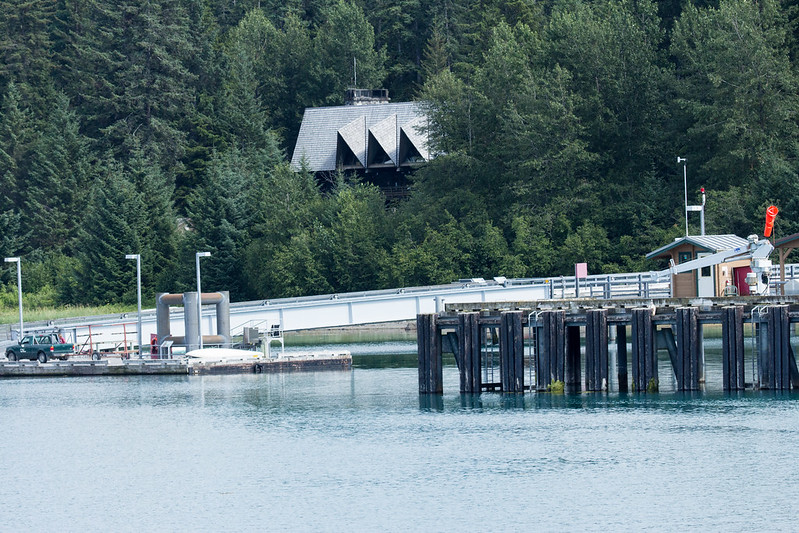
It is located at the head of the Bartlett Cove public use dock. Required orientations for campers and boaters are held here. This is also referred to as the Backcountry Visitors Station.
Yakutat District Ranger Office
This is a shared office with Wrangell – St. Elias National Park and Tongass National Forest at the base of the St. Elias Mountains. It is located in Yakutat between Wrangell and Glacier Bay National Park, approximately 220 air miles northwest of Juneau.
Dry Bay Ranger Station
This is a seasonal ranger station in the summer located in the national preserve and usually occupied between May and October.
Glacier Bay Hiking Trails:
Forest Trail – This one mile loop that returns hikers to the Glacier Bay Lodge area via the Beach Trail starts with a wheelchair accessible boardwalk to two viewing decks over a pond.
Tinglit Trail – This is a 1/2 mile one way trial that passes by the Huna Tribal House. You can also see a traditional Tlingit canoe and a complete whale skeleton.
Bartlett River Trail – The trail is a 4 mile round trip from the trailhead (and an extra mile (roundtrip) to/from the Glacier Bay Lodge and visitor center). The trail passes through a spruce and hemlock forest and ends at the mouth of the Bartlett River. Salmon run up the Bartlett River in the late summer which draws harbor seals.
Bartlett Lake Trail – This is a 10 mile out and back from the Glacier Bay Lodge Area, the longest in Glacier Bay National Park. It starts out along the Bartlett River Trail for 3/4 of a mile and then branches off for a 4 mile stretch up the moraine to the lake. The lake is also accessible from the Towers Road Trailhead at the park boundary with Gustavus. The first 1.7 miles of the Towers Trail is an old roadbed that can be used for biking as well.
Beach Trail – This trail stretches south of the dock along the shoreline. There are sea birds and intertidal life during low tide.
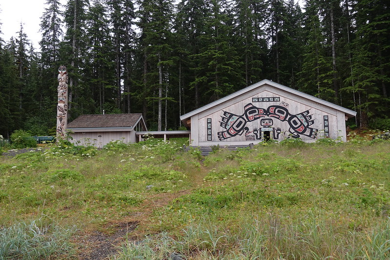
Huna Tribal House
Thousands of visitors every year go to the Huna Tribal House in the summer, which was dedicated in 2016. It memorializes the clan houses of the Huna Tlingit that once lined the shores of Bartlett Cove. The people were pushed out by the advance of the Grand Pacific Glacier during the Little Ice Age in the mid-1700s extended to Bartlett Cove, and returned after the glacier receeded. Artifacts in the Glacier Bay area from the Huna Tlingit date from as early as 1250, although they are expected to have lived in the region for much longer. Many Huna live 30 miles south in the village of Hoonah.
There have been many issues between the park service and the Huna Tinglit of the area over the years, as the NPS took their land for the national monument and limited their hunting rights. The idea of building the Huna Tribal House was adopted in 1997 by the National Park Service, but it was not funded until 2013 when the park superintendent allocated $2.9 million in concessionaire franchise fees to its construction. The groundbreaking ceremony happened in 2014.
The house is 28,000 square feet and serves as a gathering center for the Huna, an educational area about the Huna culture for the park’s visitors, and a place to display their artwork and cedar carvings. The totem poles in the area were carved by a Huna carver hired to produce the traditional Huna Tlingit art.
The path near the tribal house has informative exhibits about the natural and cultural history of the park.
Icy Strait and Glacier Bay Whale Watching
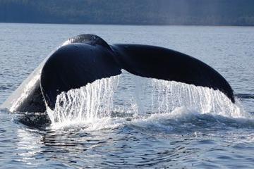
Seeing a humpback whale is an incredible experience, as these endangered animals can weigh 40 tons and measure 40-50 feet in length. Glacier Bay is a sanctuary for them, with some of the strongest protections on the planet.
Humpback whales travel to Glacier Bay during the summer from Hawaii or Mexico to eat small schooling fish from the cold waters. They can eat almost 1/2 ton of food every day.
A massive humpback whale skeleton – whale 68 aka “Snow” – has been on display in Bartlett Cove since September 2014. This female whale was a regular visitor from 1975 until July 2001, when it was struck by a cruise ship and found floating dead at the mouth of Glacier Bay.
Point Adolphus at the edge of Glacier Bay National Park by the intersection of the bay with the Icy Straight is an active feeding ground for whales and one of the best humpback whale viewing areas in Alaska.
Orcas (aka killer whales) can also be seen in the area. They are considered the ocean’s most intelligent predator. They are actually the largest of the dolphin family, rather than a whale.
Icy Strait is a forty mile stretch of water located south of Glacier Bay, separating Chichagof Island to the south and the Alaska mainland to the north.
Other Things to Do in Glacier Bay National Park
Glacier Bay Sea Kayaking
There are kayak rentals for both single day and multi-day fiberglass sea touring kayaks for one and two people. You can also arrange a guided trip.
Glacier Bay Sea Kayaks provides kayak rentals from the Glacier Bay Visitor Information Station in Bartlett Cove. There are half day (morning or afternoon) and full day tours and rentals. They have been operating since 1978. Note: they do not rent kayaks to solo paddlers regardless of experience.
If you wish to engage in a backcountry trip by kayak, you can arrange in advance for transportation up the bay on the daily boat tour. It provides drop offs at several different locations (depending on time of year, sometimes the day and also the weather) including Mt. Wright, Scidmore, Blue Mouse Cove, Ptarmigan Creek and Sebree Island. There are two scheduled drop offs each day. Check with the Visitor Information Station for approximate pick up / drop off times.
Backcountry users must acquire a free permit and take a short class. All food and scented items should be stored in a bear-resistant food canister. Kayakers should also be aware of the tides which change up to 25 feet every six hours.
Another destination is Point Adolphus, which is known as one of the best whale watching destinations in North America. Whales are found throughout Alaska in the summer as they feed before leaving for the winter.
Another popular area for a quick trip is the Beardslee Islands. This is a group of islands north of Bartlett Cove and Glacier Bay Lodge.
Sunset at Halibut Point
Halibut Point is also a good place to see whales from the shore, particularly in June. It is located near the Bartlett Cove Campground at the end of the Beach Trail. It is a little over a half mile from Glacier Bay Lodge, near the outlet of the Bartlett Cove to the main channel.
Glacier Bay Flightseeing
Take a scenic flight over the park to see the mountains and glaciers from the air. There are private flight operators available from Gustavus, Yakutat, Haines, Skagway and Juneau. Most people see the park from a cruise ship, so this will offer a unique perspective over the area.
If your cruise ship is not going up Glacier Bay and is instead stopping at Skagway, you can arrange for a one-two hour flightseeing tour from there. For an extra fee, you may be able to arrange a beach or glacier landing.
East Arm Flightseeing
Discover the glaciers and mountains of the East Arm of the park. Since it is the closest area to Haines and Skagway, it is the quicker option if time is short.
West Arm Flightseeing
The Fairweather mountain range and many of the park’s famous tidewater glaciers are located on the West Arm, such as the Grand Pacific and the Marjorie Glaciers in the Tarr Inlet as well as the John Hopkins, Lamplugh and Reid Glaciers
Bracy Icefield is located in Glacier Bay National Park east of the Fairweather Range and is the origin of the Brady Glacier, Lamplugh Glacier and Reid Glacier.
Pacific Coast / Western Park Boundary
Lituya Bay is a tidal inlet on the western side of the West Arm that measures seven miles long and up to two miles wide. It has the world’s largest recorded tsunami, a 1720 feet wave at its maximum height caused by a rockfall in the bay from a magnitude 7.7 earthquake that happened on the Fairweather Fault on July 9-10, 1958. There had previously been at least three other major tsunamis at this location.
La Perouse Glacier is the only tidewater glacier in the park with calving directly into the Pacific Ocean. The glacier starts on the south slope of Mount Crillon and flows around 15 miles to the Gulf of Alaska. The ocean facing ice wall is 200 to 300 feet high. The glacier was named in 1874 for 18th Century French naval officer Jean François de Galaup, comte de La Pérouse.
Glacier Bay Fishing
Glacier Bay Lodge has fishing poles and spin casting gear available for rent. Freshwater contains salmon, steelhead, cutthroat and Dolly Varden char. An Alaskan sportfishing license is required in the park for all nonresidents 16 and older, and for Alaska residents 18-59, to fish in Alaska’s fresh and salt waters.
The Bartlett River is popular for sockeye and coho. All harvested fish caught in the Bartlett River must be kept within six feet of the angler due to bears. Additionally, all harvested fish caught in the Bartlett River shall be packed out whole, except gills and entrails which should be deposited in the deepest, fastest flowing part of the stream channel. Fish carcasses may not be disposed within 200 feet of the Bartlett Cove dock.
The Salmon River which flows through Gustavus has a run of coho (silver) salmon in the summer. They are typically available from mid-July through September:
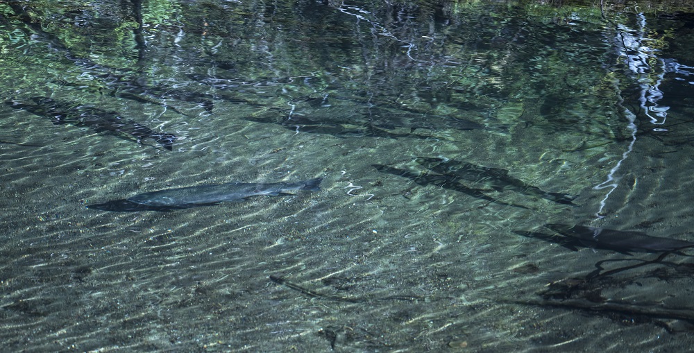
There are also half-day and full-day fishing charters from Gustavus for salmon fishing or halibut fishing. The Icy Strait, south of Gustavus (between there and Hoonah) is some of the best halibut fishing in Alaska.
Glacier Bay Halibut Fishing
According to the Alaska Sporting Journal – “No other area of Alaska yields as many halibut over 200 pounds for sport anglers as the fish-infested waters where Icy Strait meets Glacier Bay.” Although people in Alaska occasionally catch halibut from a sea kayak, I would book a fishing charter out of Gustavus.
Halibut thrive in Glacier Bay and are a popular target of sportfishing. The park has one of the healthiest remaining populations of Pacific halibut, as they have been on the decline in other areas due to commercial and recreational overfishing.
The Pacific halibut has a flat, diamond shaped body and is the largest of all flatfish. They can live for over 40 years and have been measured at 500 pounds.
Halibut are a bottom dweller that can live in water up to 1200 meters deep. They are born with an eye on each side of their head but one eye migrates to the other side in order to enable them to see predators and prey. The upper side of the fish often looks like the ocean bottom to help hide them from both predators and prey.
The Pacific halibut fishery is managed by the federal government under international treaty with Canada. Federal halibut regulations are available from NOAA. There are separate regulations for this area for guided and unguided halibut fishing. The Alaska Department of Fish and Game has also adopted some regulations that affect sport fishing for halibut. Be sure to check out the applicable regulations before your trip.
Gustavus Whale Watching
In the summer, there are whale watching boat excursions in the morning and afternoon. The TAZ is a 50 foot vessel which departs from Gustavus City Dock and travels to Point Adolphus outside of the park. The boat looks for humpback whales in their summer feeding grounds as well as other types of whales in the area.
Glacier Bay Birdwatching
There are over 275 birds documented in the area, which is rich in seabirds, shorebirds, and waterfowl. Birds are most abundant from May to mid-September. Seabird colonies hatch in late June and are largely gone by the beginning of September. The area has as much as 20 percent of the global population of Kittlitz’s Murrelet, and the Marbled Murrelet is common in the area. There are numerous points in the area on the Southeast Alaska Birding Trail, and the park service recommends 15 locations in the area for birding.
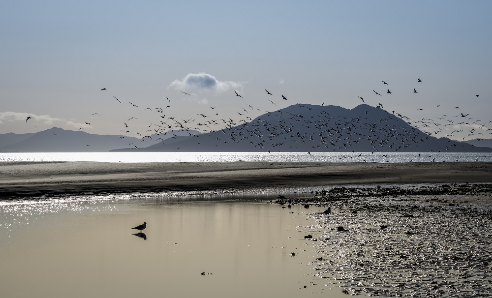
The below photo is of Gustavus Beach:
About Gustavus
Gustavus is a town on Icy Strait in Alaska which is home to approximately 450 people. It is the gateway town for the park and is located about 9 miles from Bartlett Cove and the Glacier Bay Lodge. The Salmon River flows through the town. It also has an airport and a beach. The closest major population to Gustavus is Juneau which is a 15 minute plane ride or three hour ferry. Lodging options in Gustavus include the Annie Mae Lodge, Gustavus Inn, Bear Track Inn, as well as the Blue Heron Bed and Breakfast.
Recent Bird Sightings
Nearby Activities:
Glacier Bay National Park Weather
[wunderground location=”Elfin Cove, AK” numdays=”4″ layout=”simple” showdata=”search,alert,daynames,highlow,pop,icon,text,conditions,date”]
Glacier Bay has wild winters and cool, moist summers at sea level due to its maritime climate.
The average mean temperature between May and September is between 45 and 55 degrees F. The average high temperature even in the warmest month (of July) is only 63 degrees F.
If you are on an Alaska cruise, you should expect to dress in layers for a cold fall or winter day, with a heavy/winter jacket just in case. You will also want to have a hat and gloves. Glacier Bay is known to be colder than the surrounding area. Many people report wearing cold weather undergarments and a fleece / heavy sweater or jacket during their Glacier Bay cruise
Average low temperatures are typically in the 40 degree range, although May sees average temperatures in Gustavus down to 38 degrees F.
You must also prepare yourself for cloud cover and rain. Average rainfall in Gustavus happens between 11 and 15 days a month during the summer season. April, May and June are on average the driest months of the year. September and October tend to be the wettest months of the year.
Average Temperature (Monthly)
Radar:
Vacation Packages:
Other Places in Glacier Bay National Park
Mt Wright
This is the early season kayaker dropoff of the tour boat in the East Arm. Mount Wright is a 5,054 foot mountain summit on the east side of Muir Inlet.
Scidmore Bay
This is a launching point for multi-day kayaking trips in the West Arm via the tour boat. The West Arm is home to tidewater glaciers including the Lamplugh Glacier and the Margerie Glacier. The bay (along with Scidmore Glacier) is named for Eliza Scidmore, who traveled through Alaska’s Inside Passage in 1883 and shared her travel logs which helped open Alaska to In 1890, she joined the new National Geographic Society. Scidmore was also responsible for working with First Lady Helen Taft to plant Washington DC’s cherry trees, after visiting Japan in 1885.
Ptarmigan Creek
It is located in the West Arm and serves as the kayaker dropoff of the tour boat one day a week during the second half of the summer.
Blue Mouse Cove
This is the kayak dropoff in the West Arm during the second half of the season for all but one day a week (when Ptarmigan Creek is used instead).
Sebree Island
Sebree Island is an island in Muir Inlet in the East Arm. This is a popular drop-off by the tour boat for sea kayaking and overnight camping. It was named around 1890 for US Navy Commander Uriel Sebree.
South Marble Island
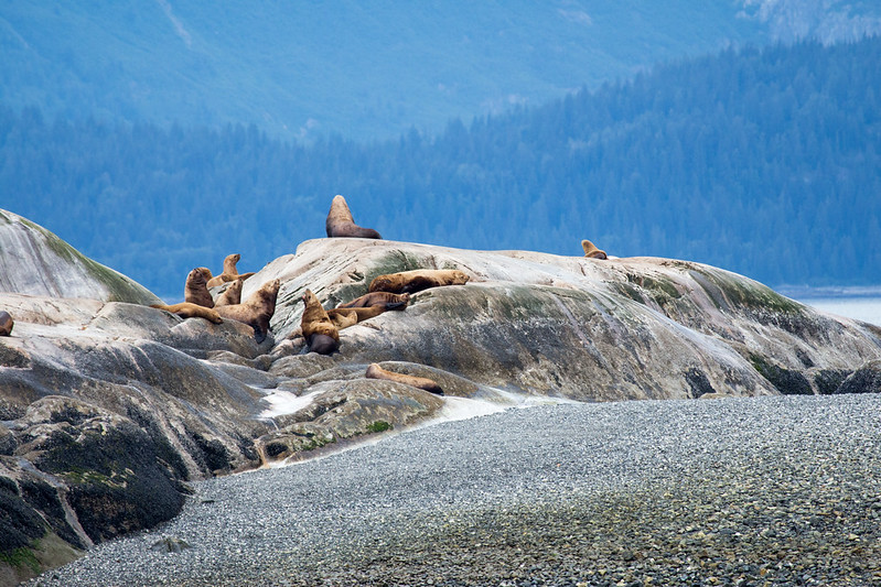
This is a remote limestone outcrop in Glacier Bay that is known as a refuge for nesting birds and sea lions. It is closed to boat and kayak landings. It serves as a nesting site to Tufted Puffins Black Oystercatchers, Pigeon Guillemots, Pelagic Cormorants, Glaucous-winged Gulls and Black-legged Kittiwakes. It is also used as a haul-out location for Steller sea lions, the largest of the eared seals who got their name from German naturalist George Wilhelm Steller.
Shop:
How to get to Glacier Bay National Park?
It is not possible to drive into the national park. The only road goes a distance of ten miles from the Gustavus Airport and Gustavus to the Glacier Bay Lodge and Visitor Center at Bartlett Cove. There are flights from Juneau to Gustavus on Alaska Airlines as well as seaplanes.
There is also a ferry from Juneau to Gustavus as part of the Alaska Marine Highway ferry system which takes approximately four hours. Visitors with cars on the ferry should be aware that there is limited parking for private vehicles in Bartlett Cove.
There are daily boat excursions and tours from the Glacier Bay Lodge.
Glacier Bay National Park Lodging
Glacier Bay Lodge – It opened in 1966 as part of facility improvements for the 50th anniversary of the National Park Service. It is the only hotel accommodations in the park and has both standard and deluxe guest rooms. The Glacier Bay Day Tour departs from the dock daily on a high-speed catamaran for an eight hour guided boat tour of the park narrated by a park ranger. Advanced reservations for the boat tour are recommended.
Glacier Bay Lodge has two floors and 48 rooms. It is typically open from mid-May to early September. However, they have announced that they will be closed for the entire 2020 season due to the coronavirus and social distancing guidelines.
It was first proposed during World War II when the airfield was built by the military. There was no infrastructure to accommodate tourists at that time, and it was thought that lodging might also provide a hotel for travelers with delayed flights due to weather (since there were none in Gustavus). However, there was no money for the hotel in the park budget at the time.
The lodge construction began in 1965 when it was still Glacier Bay National Monument, after the money was allocated as part of the Mission 66 project. This would be the only federal funds used to construct overnight visitor accommodations during Mission 66.
The lodging opened in June of 1966, one of the last to be completed as part of the project. It celebrated 50 years in operation in 2017.
They serve breakfast, lunch and dinner in the Fairweather Dining Room or outside on the deck in the afternoon and evening.
Glacier Bay National Park Camping
There is a free, walk-in tent campground at Bartlett Cove accessible by foot. There are no RV facilities or vehicle camping areas. A free permit is available between the beginning of May and the end of September, required for both backcountry camping and the Bartlett Cove Campground. A 30 minute orientation at the information station is required of all campers. Certain areas of the park may be closed to camping due to animal activity or to protect resources.
Other Options – There are several inns and lodges as well as a bed and breakfast around Gustavus, Alaska.
American Samoa
Arches
Badlands
Big Bend
Biscayne
Black Canyon
Bryce Canyon
Canyonlands
Capitol Reef
Carlsbad Caverns
Channel Islands
Congaree
Crater Lake
Cuyahoga Valley
Death Valley
Denali
Dry Tortugas
Everglades
Gates of the Arctic
Glacier Bay
Glacier
Grand Canyon
Grand Teton
Great Basin
Great Sand Dunes
Great Smoky Mountains
Guadalupe Mountains
Haleakala
Hot Springs
Hawaii Volcanoes
Hot Springs
Isle Royale
Joshua Tree
Katmai
Kenai Fjords
Kings Canyon
Kobuk Valley
Lake Clark
Lassen Volcanic
Mammoth Cave
Mesa Verde
Mount Rainier
North Cascades
Olympic
Petrified Forest
Pinnacles
Redwood
Rocky Mountain
Saguaro
Sequoia
Shenandoah
Theodore Roosevelt
Virgin Islands
Voyaguers
Wind Cave
Wrangell-St. Elias
Yellowstone
Yosemite
Zion


